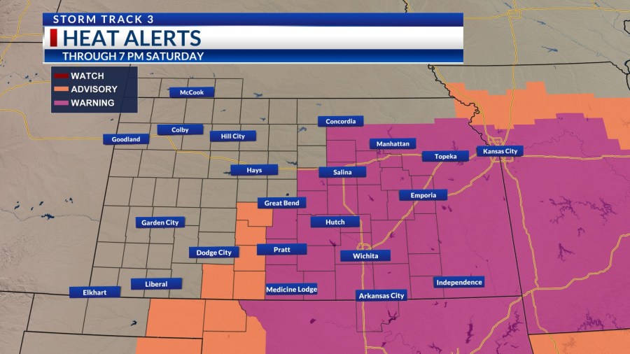
Extreme Heat Alerts have been expanded and extended into Saturday with potential heat indices up to 112 degrees.
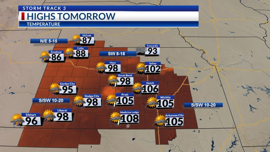
The air temperature in places like Wichita will be able to exceed 100 degrees today and again on Saturday before trending cooler as a front tracks across the state late this weekend.
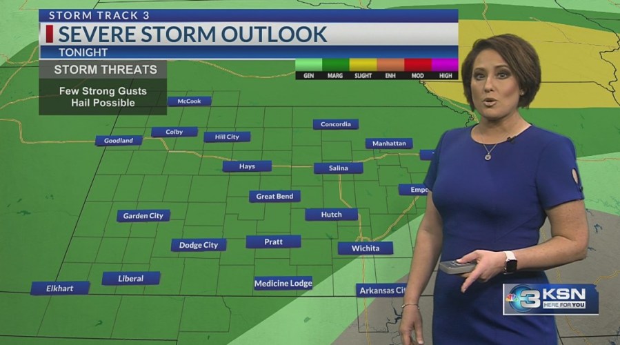
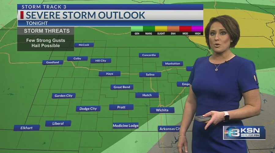
This front will enable another round of scattered showers and storms this evening that will carry through the overnight. Areas west of I-35 are in the targeted zone for this hit or miss activity.
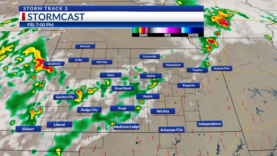
A few storms could once again pose a threat for damaging winds from 60-80 MPH. The hail threat is low. Storms will track to the northeast through Saturday morning and exit.
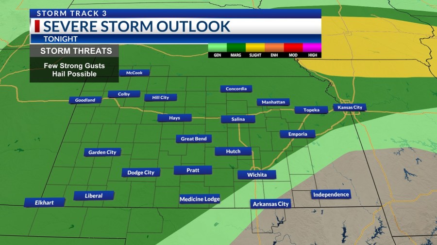
A rinse and repeat cycle is a good way to describe our current pattern. Saturday morning looks dry for most before more scattered showers and storms form from late afternoon into the night. Saturday will be hot again south of the boundary with highs exceeding 100 degrees.
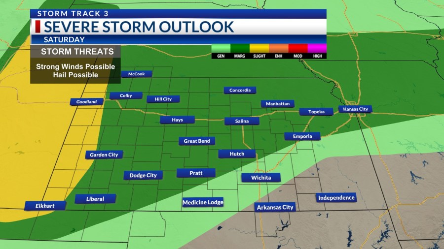
The front should come through on Sunday, helping spark more scattered showers and storms from the second half of Sunday into early Monday.
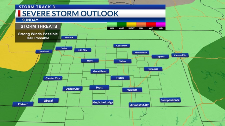
Temperatures will drop to the 80s and lower 90s late this weekend into early next week. The heat builds back by Tuesday, although not as intense as this week’s heat wave has been for us.
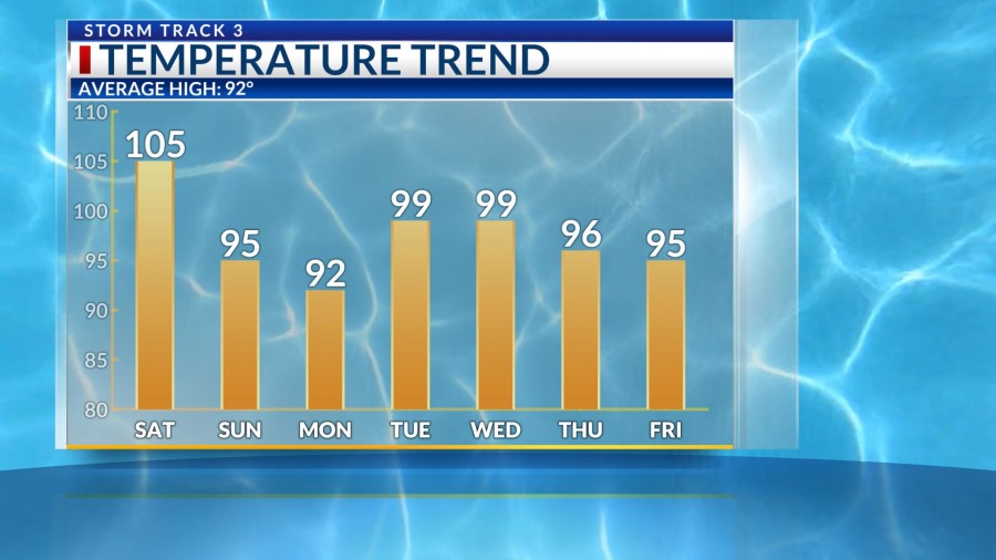
There will still be areas near and especially south of the Oklahoma state line that hit the century mark mid to late next week. The pattern may become more active with renewed chances for rain toward the back half of next week.
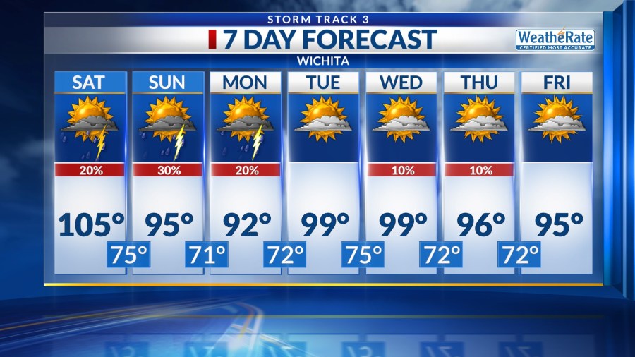
KSN Storm Track 3 Forecast from Chief Meteorologist Lisa Teachman:Wichita:Tonight: Partly cloudy. 20% chance of showers and storms. Lo: 77 Wind: S 5-15Tomorrow: Partly cloudy, breezy. 20% chance of showers and storms. Hi: 105 Wind: S/SW 10-20Tomorrow Night: Partly to mostly cloudy. 20% chance of showers and storms. Lo: 75 Wind: SW/N 5-15Wichita WeeklySun: Hi: 95 Lo: 71 Mostly to partly cloudy. 30% chance of showers and storms.Mon: Hi: 92 Lo: 72 Partly cloudy. 20% chance of showers and storms.Tue: Hi: 99 Lo: 75 Mostly sunny to partly cloudy, breezy.Wed: Hi: 99 Lo: 72 Mostly sunny to partly cloudy, breezy. 10% chance of showers and storms.Thu: Hi: 96 Lo: 72 Mostly sunny to partly cloudy, breezy. 10% chance of showers and storms.Fri: Hi: 95 Lo: 71 Mostly sunny to partly cloudy, breezy.
SOUTHWEST: Dodge City, Garden City, Liberal, Greensburg, GuymonSouthwest:Tonight: Partly to mostly cloudy. 50% chance of showers and storms. Lo: 69 Wind: S 5-15Tomorrow: Mostly to partly cloudy. 30% chance of showers and storms. Hi: 95 Wind: S/SW 10-20Tomorrow Night: Partly to mostly cloudy. 70% chance of showers and storms. Lo: 68 Wind: SW/N 5-15Southwest WeeklySun: Hi: 84 Lo: 65 Mostly to partly cloudy. 40% chance of showers and storms.Mon: Hi: 86 Lo: 65 Partly cloudy. 30% chance of showers and storms.Tue: Hi: 95 Lo: 67 Mostly sunny to partly cloudy.Wed: Hi: 93 Lo: 66 Mostly sunny to partly cloudy. 10% chance of showers and storms.Thu: Hi: 93 Lo: 66 Mostly sunny to partly cloudy. 10% chance of showers and storms.Fri: Hi: 93 Lo: 66 Mostly sunny to partly cloudy.
NORTHWEST: Colby, Goodland, Hill City, Oberlin, McCookNorthwest:Tonight: Partly to mostly cloudy. 50% chance of showers and storms. Lo: 67 Wind: E/N 5-15Tomorrow: Mostly to partly cloudy. 30% chance of showers and storms. Hi: 88 Wind: N/E 5-15Tomorrow Night: Partly to mostly cloudy. 70% chance of showers and storms. Lo: 66 Wind: E/N 5-15Northwest WeeklySun: Hi: 83 Lo: 65 Mostly to partly cloudy. 30% chance of showers and storms.Mon: Hi: 83 Lo: 65 Partly cloudy. 20% chance of showers and storms.Tue: Hi: 93 Lo: 65 Mostly sunny to partly cloudy.Wed: Hi: 90 Lo: 64 Mostly sunny to partly cloudy. 20% chance of showers and storms.Thu: Hi: 88 Lo: 63 Partly cloudy. 10% chance of showers and storms.Fri: Hi: 89 Lo: 65 Mostly sunny to partly cloudy.
NORTHCENTRAL: Salina, Great Bend, Hays, Russell, Beloit, OsborneNorth Central:Tonight: Partly to mostly cloudy. 30% chance of showers and storms. Lo: 77 Wind: S/SW 5-15Tomorrow: Mostly to partly cloudy. 20% chance of showers and storms. Hi: 102 Wind: SW 8-18Tomorrow Night: Partly to mostly cloudy. 40% chance of showers and storms. Lo: 74 Wind: SW/N 5-15North Central WeeklySun: Hi: 87 Lo: 71 Mostly to partly cloudy. 30% chance of showers and storms.Mon: Hi: 87 Lo: 71 Partly cloudy. 20% chance of showers and storms.Tue: Hi: 97 Lo: 74 Mostly sunny to partly cloudy.Wed: Hi: 94 Lo: 70 Mostly sunny to partly cloudy. 20% chance of showers and storms.Thu: Hi: 90 Lo: 70 Mostly sunny to partly cloudy. 10% chance of showers and storms.Fri: Hi: 91 Lo: 71 Mostly sunny to partly cloudy.
–Chief Meteorologist Lisa Teachman
Copyright 2026 Nexstar Media, Inc. All rights reserved. This material may not be published, broadcast, rewritten, or redistributed.
For the latest news, weather, sports, and streaming video, head to KSN-TV.